INTRODUCING
BOOKINGS ON WIKICAMPS
Lake Cohen
 Campground
Description
Water Body
Position
DEG: -24.456512 125.040451
DMS: 24º 27' 23.44' S 125º 02' 25.62' E
UTM: 51 J 7293705mN 706827mE
Altitude: 414m
Named by Royal Australian Survey Corps after WO2 Cohen, a member of the 1961 reconnaissance survey field party which carried out a series of astro-fixes in the area, Lake Cohen is a broad series of clay pans that fill after significant rainfall within the Gibson Desert region. Bordering the Gary Highway approximately 82 kilometres north of the Gunbarrel Highway. When full, this ephemeral lake covers an area of two square kilometres and provides a haven for migratory birds.
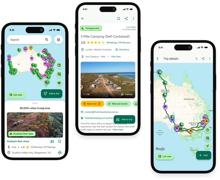
Find this site and more on WikiCamps
Take the ultimate camping companion on your next trip, with these great features:
![]() Explore more than 60,000 sites across Australia with detailed site information at your fingertips
Explore more than 60,000 sites across Australia with detailed site information at your fingertips
![]() Stay in the know with exclusive, insightful reviews from fellow travellers
Stay in the know with exclusive, insightful reviews from fellow travellers
![]() Map journeys, plan your route, and gauge your fuel spend with Trip Planner
Map journeys, plan your route, and gauge your fuel spend with Trip Planner
![]() No signal? No worries! Use offline mode to travel anywhere with WikiCamps
No signal? No worries! Use offline mode to travel anywhere with WikiCamps
![]() Add sites to your collections, search with intuitive filters, and so much more...
Add sites to your collections, search with intuitive filters, and so much more...
Get WikiCamps now!
Download WikiCamps from the App Store on your device.

